

ARS – Autonomous Remote Sensing
Autonomous Remote Sensing.
Description
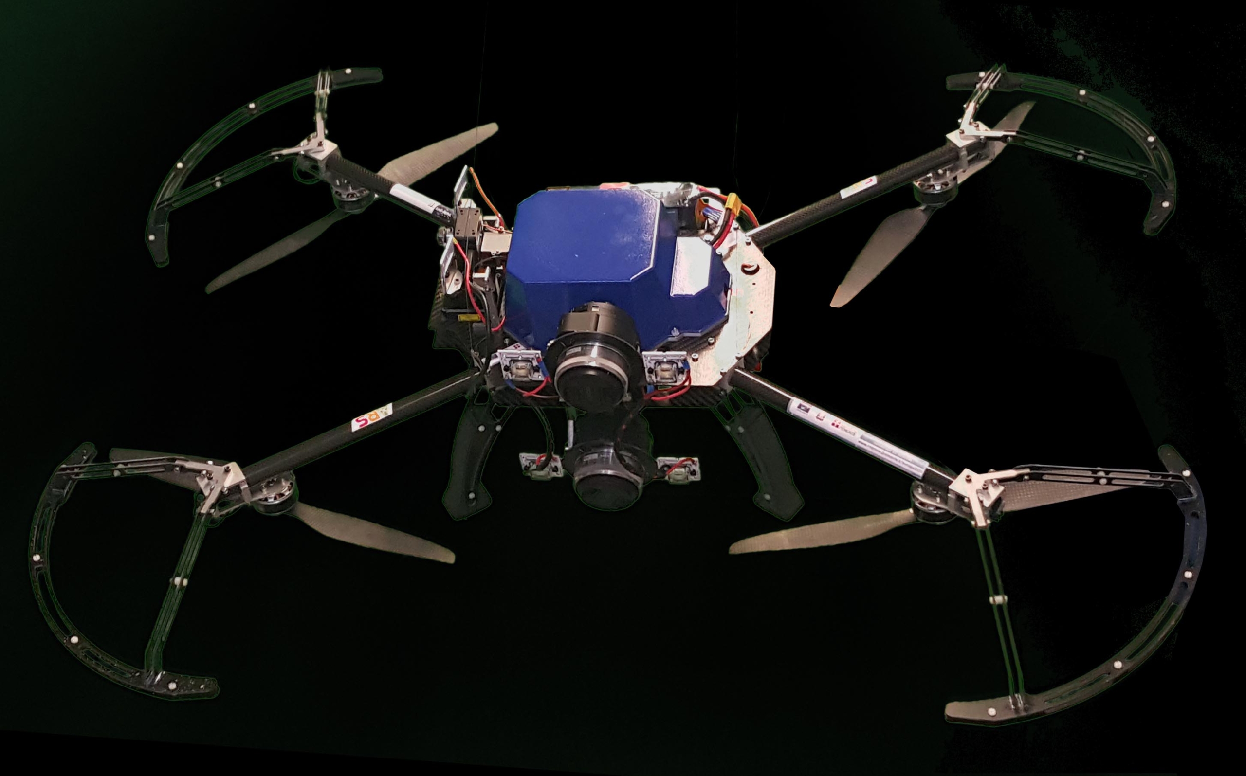
The ARS project is aimed at the realization and testing of a drone capable of performing the autonomous inspection of confined spaces and in particular tunnels. The system:
– performs in total autonomy the inspection of confined spaces where communication with the outside is absent
– interfaces automatically to fixed sensors installed inside the tunnel to take the data stored during monitoring
– realizes a 3D mapping to be used (together with the data coming from the sensors) for geotechnical and structural monitoring of the explored environment.
Result to be enhanced
Autonomous navigation in confined spaces: the system is based on autonomous navigation software that uses visual inertial technologies to be able to navigate in environments where GPS signal is not available.
Why is it important?
The designed system makes it possible to:
– reduce human presence in underground or confined spaces
– explore very large or difficult-to-access areas
– increase the amount of data acquired, retrieving information in less time than manual surveying and inspection activities
– retrieve data from sensors installed even in the absence of communication with the outside world.
Project sheet
Link video
Project and Acronym: ARS – Autonomous Remote Sensing
TRL: Partenza 4 – Arrivo 7
Reference call: Linea A
Innovation Cluster to contact: Clever
Technologies used: the drone is equipped with:
– a high-performance computer
– high-resolution cameras
– LIDAR
– altimeter
– compass
– gyroscope
– GPS
– high-precision IMU
– LED lighting system
The system bases its architecture on ROS (Robot Operating System)
Lead company:
WPWEB S.r.l
info@wpweb.com | www.wpweb.com |
Collaborating companies:
Capetti Elettronica S.r.l
Gd test S.r.l
